

The Ellis Brook Valley Reserve covers a scenic area and forms part of the western scarp of the Darling Plateau. The Reserve is part of the Banyowla Regional Park, named after a Nyoongar elder. Ellis Brook is named after Captain T. Ellis, a police superintendent of the 1830s. A City of Gosnells brochure of the area notes over 500 plant species and more than 100 animal species have been identified in the Reserve.
The hills and slopes are of Archean granites (2600-2700 Ma) intruded by dolerites (1200 Ma), together forming part of an extensive geological terrain termed the Yilgarn Craton. The scarp is dissected by the Ellis Brook stream, unfortunately dry at this time in the season. It is a narrow, immature stream course with loose boulders, pools and nick points. From the hillsides there are good vantage points eastwards to the flat-lying coastal plain and Perth City.
The DRB group had decided to undertake the longest of the walk trails (The Sixty Foot Falls walk).
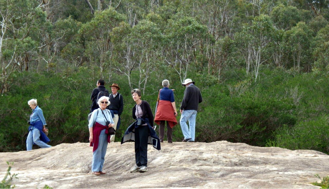
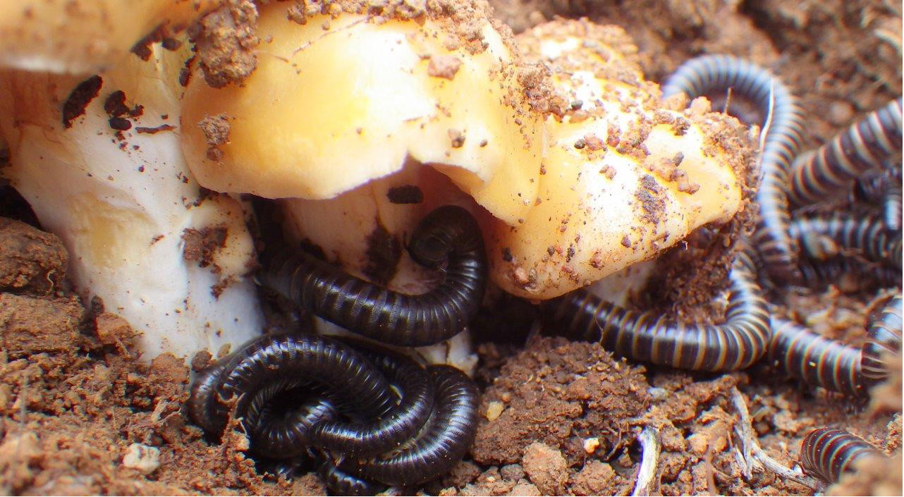
The walk began from the car park where there is an information pavilion, and at the time, two wedge-tail eagles were soaring above us. The path proceeds to the top of the waterfall on a track well maintained with some stepped sections and a lookout viewing platform towards the top. This first part of the walk, all on the southern flank of the stream, covers large areas of granite rock outcrop in which different types of granites can be recognised, some traversed by small veins of pegmatite and quartz. The weathering patterns on both granites and loose dolerite boulders, used along the pathways, are also very distinctive. Along the pathway a number of plants were in flower including Astroloma foliosum (Candle Cranberry), Darwinia citriodora (Lemon-scented Darwinia), Conostylis androstemma (Trumpets) and Banksia nivea (Honeypot Dryandra). The hillsides were thickly vegetated by dominant Calothamnus quadrifidus (One-sided Bottlebrush), not yet in flower, dotted with Xanthorrhoea preissii (Grass trees) and Macrozamia sp whilst small shrubs of Acacia pulchella (Prickly Moses) Hakea petiolaris (Sea Urchin Hakea), Hibbertia sp, Grevillea bipinnatifida (Fuchsia Grevillea) and Isopogon dubius (Pincushion Coneflower) were all in flower. Lower growing Bossiaea sp. was dotted on the hillsides and Dioscorea hastifolia (Warrine) was fairly widespread, and both are in flower. Numerous bird calls were clearly heard along the way but few species were identified; New Holland honeyeaters, western spinebill and grey fantails were seen. Some fungi were also seen on this part of the walk, with two opened, ochre-coloured earthballs, possibly Cortinares, having pushed up crusts of earth. Native millipedes (somewhat larger than their pesky Portuguese equivalent) had utilised the fungi for shelter and several mature (dark with pale bands) and some immature ones were curled up beneath each of the two fungal eruptions.
At the hilltop, the jointed nature of the granites is well exposed and has produced both a blocky style of boulders and some sheet structures. Some small pools of water were evident in small gnammas, weathered along prominent veins within the granite. Some can be followed over several metres. The rock surfaces in this area were stained with black algae along runnels. The dolerite contact is clearly seen at the northern edge of the falls, where thicker red soil and boulder-containing regolith covers the upper slopes and supports mixed Eucalyptus wandoo (Wandoo) with some Corymbia calophylla (Marri) woodland. A small group of Eucalyptus lane-poolei (Salmon White Gum) was also noted at the top of the falls.
The second section of the walk proceeds through the Wandoo woodland to the fenced border of the Old Barrington Quarry and then descends to a section of the quarry. A short walk eastwards along the old road into the main quarry gave us the opportunity to see the scale of operation, when between the late 1950s and early 1960s many tonnes of both granite and dolerite were quarried and utilised as road and building aggregate. Jointing in the rocks here, notably the dolerite, supports good clusters of ferns (Cheilanthes sp.). A pair of Australasian Grebe (Tachybaptus novaehollandiae) had the small quarry waterpool to themselves. (The pool was once used as a swimming hole known as ‘the rockies’ but for health and safety reasons is no longer used.) The quarry area provided an interesting spectacle where excellent exposures of the granite and dolerite could be viewed. Two Red-tailed Black Cockatoos (Calyptorhynchus banksii) were spotted overhead during this section of the walk.
The pathway ends back at the car park, via a fairly steep granite section. The group finished the day at the Honeyeater car park with a picnic lunch under shelter, as rain began.
Features and facilities of the Ellis Brook Valley can be viewed on the City of Gosnells website. The area is well maintained by both Gosnells City and the Friends of Ellis Brook Valley (Inc.).
Susan Stocklmayer
Photographs by Diana Papenfus